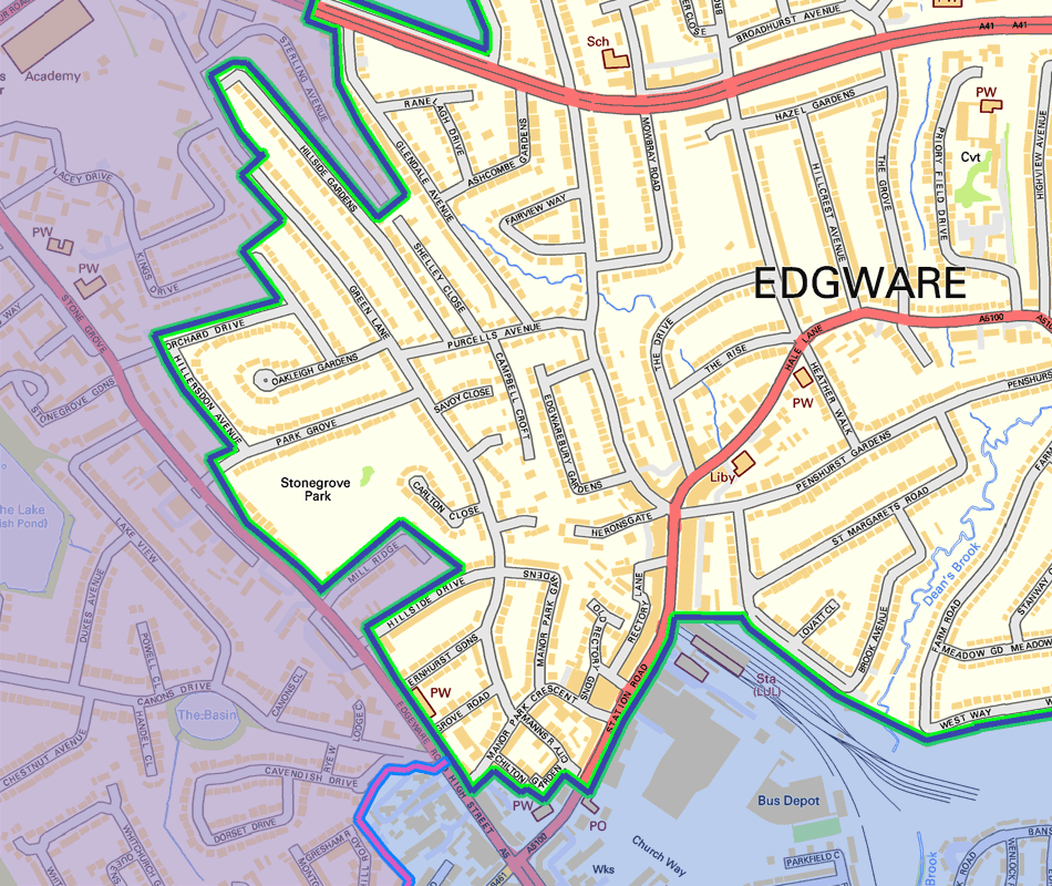
Edgware Eruv Map - South West
Stonegrove Park is inside
the Edgware Eruv. The
gate on Stonegrove marks
the boundary between the
Edgware Eruv (in the park)
and the Stanmore Eruv
(on Stonegrove)
The final pedestrian overpass
of the A41 Edgware Way is
outside of the
Edgware Eruv,
but is within the
neighbouring
Stanmore Eruv
supervised by
The London Beth Din
The Eruv stops before the old
Post Office on Station road,
just beyond the entrance to
Broadwalk car park.
It is not
included nor is the opposite
side from that point down to
Stonegrove
A5, Edgware High Street, Stonegrove
is always completely outside of the
Edgware Eruv and all houses and
buildings opening onto it are also
completely outside of the Edgware
Eruv.
Note that some of Stonegrove is
within the neighbouring Stanmore
Eruv supervised by The London
Beth Din
Map Contains Ordanance Survey data © Crown copyright and database right 2011